Major changes in landform have occurred to unprotected shorelines along Virginia’s Northern Neck shoreline. In some locations, such as Hog Island and Hull Creek, major shoreline losses have occurred, also changing local bottom and shoreline features. Entrances to some of the creeks and rivers have shoaled or sanded in, and inside some of the larger Virginia tidal creeks and rivers with open entrances, there are oyster ground leases where oysters are grown commercially in cages spread out across vast areas of tributary bottoms. Thus, there is a diverse array of structure of interest for sportfishing. In this piece, we’ll look at the shoreline and near shore features from Ragged Point to Bonum Creek.
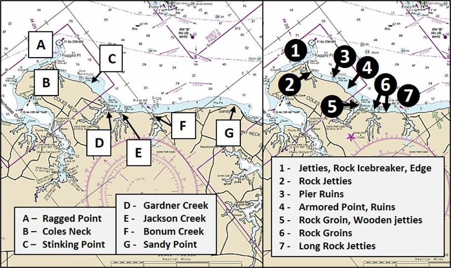
Ragged Point Light
During the Spring striper trophy season years back, my fishing partner and I were trolling over to Ragged Point where bait was shooting off the upriver edge of the natural channel west of the point on a strong ebb. The geographic and bathymetric configuration of the edge at this turn and constriction in the river channels pushes currents out towards the middle of the river and over towards Piney Point, producing a “bait chute” that concentrates and delivers baitfish to waiting striped bass in the spring and fall. Some big stripers liked what we were offering.
A rock icebreaker is on the west side of the Ragged Point Light at Site 1. Rock piles were constructed to protect navigation light structures and lighthouses from ice moving down the Bay or rivers, or in some locations such as the Sharps Island icebreaker, pushed back up the water bodies by tidal currents and wind. Although rarely needed now, these relics serve as artificial reefs. When fishing the Ragged Point icebreaker try casting jigs and lures. Also try jigging around the legs of the light structure.
Ragged Point to Gardner Creek
Back along the shoreline, there is a sanded-in inlet on the upriver (west) side of Ragged Point. The west side of the inlet is formed by a rock jetty. The east side is a wooden bulkhead. These structures jut out abruptly from the shoreline and disrupt the current flow. Try tossing jigs and lures to the end of the jetties when current is present. On the downriver side of the point, check the ledge that extends south and curves back to Ragged Point. It’s positioned to intercept bait moving upriver on flood currents creating conditions where predators can wait in ambush.
Site 2 southeast of Ragged Point marks two rock jetties that guard the entrance to Tim’s at Coles Point. Site 3 marks pier ruins which extend well off the shoreline out to 325’. There is a submerged rectangular frame with crossmembers just inside the pier ruins’ outer end on the northwest side resembling the ruins of a duck blind. About 3000 yards south-southeast of Ragged Point Light just past “Stinking Point” (who knows where that place name came from?), there’s a little rock armored point at Site 4. It juts out about 150’ at its southeastern end where there is an old, awash jetty. Immediately to the south is a little shallow cove with debris on the bottom that could be the remains of a duck blind. At the midpoint of the cove, there is a rock-armored rectangular pad with two short rock groins that jut out at a right angle. If fishing along the shoreline, this would be a “stand off and cast in” spot that might hold a few fish.
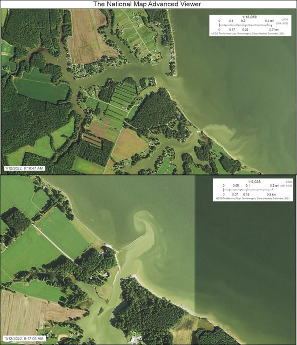
Site 5 marks the northside entrance to Gardner Creek. The shoreline approaching this point is armored with rock. The rock extends past the point slightly to create a short groin. Immediately to the west along the south side of the point are six jetties. The positioning of the point makes it a casting spot. On the south side of the entrance, the shoreline falls off to the southeast as shown in Image 3. The shoreline here is unarmored except for a series of failing wooden jetties or bulkheads that project out from the shoreline at a right angle. Water depths are shallow, so this is also a spot where you’ll want to stand off and cast in.
Gardner Creek to Sandy Point
Additional jetties dot the shoreline south of Gardner Creek down to the opening to Jackson Creek where Site 6 marks a large number of rock jetties and groins. They begin with a short but substantial rock jetty on the north side of the creek entrance. A rectangularly-shaped block is submerged on the northeast tip of the jetty. There are three similar blocks just off the northwest tip of the jetty, at least one of which appears to cover and uncover. The other two are submerged in the satellite images that were reviewed. The northwest side of the jetties is very shallow. Northwest of the jetty about 250 yards at coordinates 38'06.541 x 76'35.817 is a charted marker. Satellite images show what appears to be a small cluster of pilings at this location.
The southeast side of the creek entrance is unprotected. However, about 150 yards southeast there is a series of over two dozen closely spaced rock groins. They begin at the northwest end with a short rock breakwater just offshore and run southeast about 400 yards. After this, the shoreline is armored with rock all the way southeast to Bonum Creek inlet which is well-protected by two rock jetties at Site 7. The upriver jetty runs towards the northeast for 200 yards. There are subsurface rocks between the visible end of the jetty and the marker. The jetty on the southeast side runs towards the north-northeast about 100 yards. The longer of the two is well positioned to intercept baitfish moving downriver on ebbs.
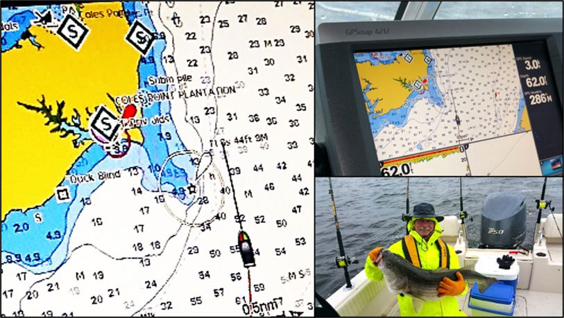
The shoreline from Bonum Creek southeast to Sandy Point is natural without prominent structure. At Sandy Point, the shoreline turns towards the south and is protected by a series of jetties that are mostly sanded-in until a residential waterfront is encountered. The shoreline turns back towards the southeast and runs towards Lynch Point. When the fish are feeding along the shoreline, there’s a lot of structure to toss to. And, if they’re not biting, there’s always Tim’s at Coles Point to check out, especially if that’s where you put in.
-By Wayne Young
As well as being a regular contributor to FishTalk, Wayne Young is the author of multiple books detailing wrecks and fishing reefs in the Chesapeake Bay, Delaware Bay, and beyond. All are available at Amazon.com, and you can find his Facebook page at “Chesapeake Bay Fishing Reefs.”