In this installment of our survey of natural formations in the Chesapeake, we’re going to take a look at three large natural anomalies on the east side of the Lower Bay. Each offers great bottom structure that draws multiple sportfish species. All are also close to well-developed artificial reefs.
Eastside Formations Below Tangier Sound
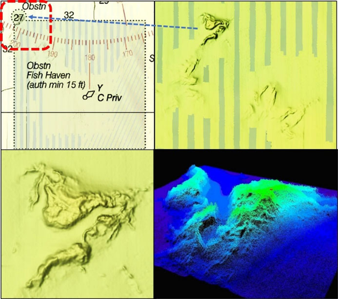
On the east side of the Bay the area below Tangier Sound is not without prominent natural formations. A rather substantial outcropping is charted as an obstruction at the northwest corner of the Nandua-Pungoteague Fish Haven. The feature is a massive natural outcropping that resembles an irregular mountaintop ridgeline with a massive deep, craggy ravine. The formation is within Bathymetric Attributed Grid (BAG) color shaded relief coverage and was also depicted using a CARIS 3D image in a National Ocean Service (NOS) report which is included in the illustration. This formation is on my old croaker list to check out. It’s a long run across the Bay from the Northern Neck and an even longer run from Point Lookout. Yet with structure like this beckoning, plus some really nice artificial structure immediately to the southeast, it’s definitely worth adding to the want-to-go to structure list.
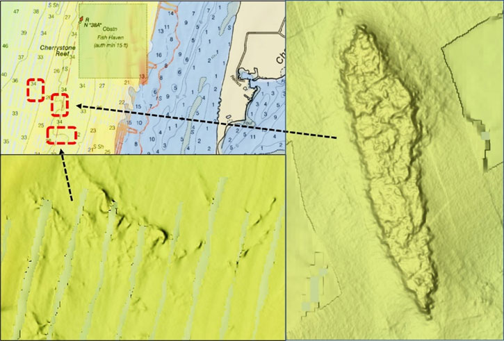
Two large natural formations further down the Eastern Shore are both features within BAG color shaded relief coverage. South southwest of Cherrystone Reef is a huge underwater formation. Charted contour lines don’t reveal the rugged character of this outcropping. As shown in the illustration, there are two additional outcroppings in the vicinity as well.
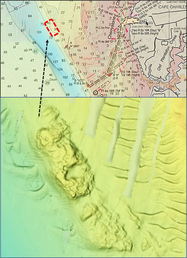
Southwest of the southwestern corner of Cherrystone Reef slightly over three nautical miles is the “Coral Lump.” This natural formation is 1200 yards northwest of Buoy R “36A” on the edge of the old bed of the Susquehanna outlet channel. Charted contour lines on the nautical chart don’t reveal the character of this rugged formation either. The Navionics sonar chart is somewhat more revealing, but the true character is shown by the BAG image. Although this formation may have corals, it gives the appearance of a natural rock outcropping. Regardless of its actual composition, the feature is massive, has a steep drop-off of over 20’, and has highly irregular texture on top. All of these eastside formations have made it onto my list as fishing destinations for Eastern Shore adventures.
The Chesapeake Bay holds many secrets, some of which are revealed by modern technology. Understanding natural formations is greatly facilitated by modern hydrographic surveys and imaging. This survey highlights much, but not all, of the hard structure that imaging has revealed to us in the area. Yet the majority of the Bay and its tributaries have not been fully mapped by modern sonar imaging. As more imaging becomes available, knowledge of heretofore unknown or little-known features may be forthcoming, along with previously uncharted wrecks and obstructions. In the meantime, there’s plenty of structure out there to explore with recreational sonars. When the screen lights up with arches or streaks showing feeding fish, it’s time to dip a worm!
-By Wayne Young
As well as being a regular contributor to FishTalk, Wayne Young is the author of multiple books detailing wrecks and fishing reefs in the Chesapeake Bay, Delaware Bay, and beyond. All are available at Amazon.com, and you can find his Facebook page at “Chesapeake Bay Fishing Reefs.”